
Chart Catalogue
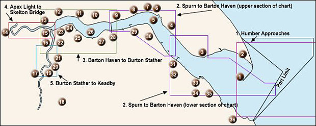
Chart Catalogue - Map Key
- Spurn to Barton Haven - upper and lower (724 kb). (Published Chart)
- Barton Haven to Burton Stather (529 kb).
- Apex Light to Skelton Bridge (357 kb).
- Burton Stather to Keadby (416 kb).
Acrobat Reader 4 or higher is required to view the above files. You can download it here .
Please note that the above charts are samples only and are of a lower quality than those we sell. These charts are not current and SHOULD NOT BE USED FOR NAVIGATIONAL PURPOSES.
Click on a chart area to see a sample of that chart and its approximate dimensions and scale. The charts shown above are those normally offered for sale and are all produced annually, with the exception of 'Barton Haven to Burton Stather', which is produced every two months due to the rapid channel changes which can occur in the Upper Humber. All of the above charts are available from any of the chart suppliers below.
B.Cooke & Son LTD
Kingston Observatory
58/59 Market Place
Hull
HU1 1RH
+44(0)1482 224412
http://www.bcookeandson.co.uk
Kildale Marine Ltd
Hull Marina
Railway Street
Hull, HU1 2DQ
+44(0)1482 227464
http://www.kildalemarine.co.uk